Hurricane Creek Road to Max Patch North Carolina
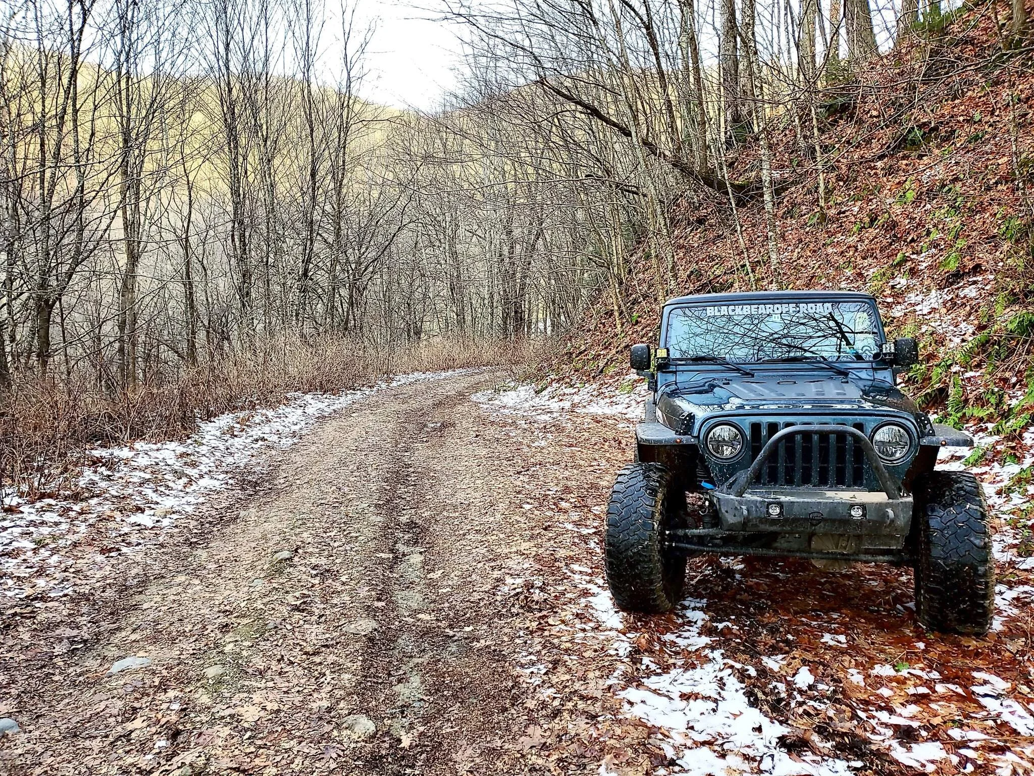
You will find the abrupt entrance to the trail inches off of I-40 Heading North in Clyde, NC. I suggest watching my youtube video and others for more information about exactly where to pull off the highway or you can easily miss the trailhead and it will cost you with a 15 mile trip to get back. The GPS Coordinates for the trail is 35.72337, -83.02656. If you plan on camping on this trail, we only noticed 2 spots along the trail, one about a quarter of the way up on the right, and another about half to 3 quarters of the way up just past a water crossing near the abandoned bus. I would rate the trail a 4 to 5 out of 10 depending on the weather conditions. However with a heavy rain or snow, this trail could be downright dangerous. I would describe the majority of the trail as bumpy, and airing down to the low 20s or high teens is recommend for your spine. The trail is very scenic and beautiful, and travels a quite a bit of elevation. You will find deep ruts, water crossings, and every size of rock. 75% of the trail can be completed in 2 wheel drive, but the sections requiring 4 wheel drive, really should be traveled in low range. A few of the off chamber section seem to point you straight at dangerous drop offs, and in snow could really be unsafe (but mostly likely fun). I think a good driver with 33s, and a winch should be able to complete the trail with out damage, but every driver and every vehicle is different, so that just my opinion. If you are a new to this area or trail, I suggest downloading a service like Gaia GPS, because with the many off shoots, it can be difficult to find Max Patch Road. When you do find Max Patch Road after a few hours of wheeling, you take a left on the 4 way road. This will lead you to the parking lot of Max Patch after a couple miles drive on a washboard but yet smooth in comparison road. A short .3 mile hike from the parking lot of will lead you to the top of Max Patch where you will see 360 degrees of breath taking mountain ridge lines, that make up the local Appalachians. The GPS Coordinates for this location is 35.79669, -82.95794. Max Patch can be reached by most vehicles if the travel on Max Patch Road, so don't be surprised to encounter other people once you arrive. This entire area is absolutely a mountain mans (or womans) haven, it just does good for the soul. It can be done in a day leaving early in the morning from the Metro Atlanta area, and is only about an hours drive to Asheville, NC and an hour and a halfs drive to Knoxville, or the Pigeon Forge/Gatlinburg Tennessee area. I highly suggest traveling this trail with at least 2 rigs, proper recovery gear, and a full tank of gas. It is enjoyable, perfectly set into nature, surprisingly clean, and ready for your next adventure.
I hope you have an epic adventure in your future.

Bradley Cohron
President/ Owner Black Bear Off-Road LLC